Close
When you prepare to relocate a vessel across several states or along a coastal route, the complexity of the move quickly becomes clear. Successful boat route planning requires more than selecting a destination and heading out. You must evaluate weather conditions, fuel range, bridge clearances, and the mechanical limits of your vessel before committing to a long journey.
For many boat owners, the idea of traveling hundreds or thousands of miles on the water sounds appealing at first. But once you begin mapping out the details, the number of variables can quickly grow.
We have seen how careful planning decides whether a delivery runs smoothly or turns into a costly and stressful experience.
Being familiar with the logistics behind long-distance routing helps you make better decisions about how to move your vessel while protecting both your boat and your time.
Long-distance relocation involves far more than plotting points on a chart. Successful route planning requires analyzing multiple layers of information that affect both safety and efficiency.
Fuel range is the first factor owners consider, but currents, tides, and wind resistance can drastically change real-world consumption. A route that looks useful on paper may require additional fuel stops if strong currents slow your cruising speed.
You must also consider the availability of reliable marinas along your route. Not every harbor offers the services your boat may require, especially if you operate specialized engines or large onboard systems.
Planning ahead ensures you know where to refuel, where to rest, and where to find mechanical support if needed.
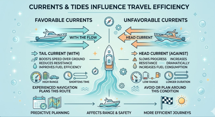
One of the most neglected aspects of long-distance routing is the effect of water movement on fuel efficiency and travel time. Ocean currents and tidal flows can either assist your progress or significantly slow it down.
For example, encountering a head current of several knots can dramatically increase fuel consumption. Your engines must work harder to maintain speed, which shortens your range and may require additional fuel stops.
Experienced navigators plan routes that align with favorable currents whenever possible. Timing a departure with tidal movement can reduce resistance and help your boat travel more smoothly.
When you factor these details into your boat route planning, you gain a clearer understanding of the real distance your vessel can safely cover in a single leg.
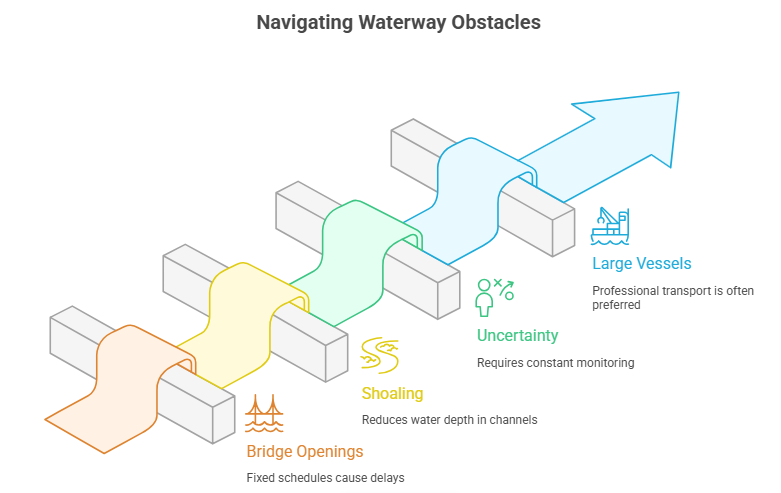
If your journey follows inland waterways or coastal channels, you will encounter obstacles that require careful scheduling and navigation. Bridges, shallow channels, and restricted waterways can drastically affect your timeline.
Bridge openings, for instance, operate on fixed schedules. Missing a bridge window by a few minutes can delay your trip by an hour or more. Multiply that delay across several bridges, and your entire itinerary can shift.
Shoaling is another factor to consider. Sand and sediment can accumulate in channels after storms, reducing water depth in areas that were previously safe to navigate.
Many owners discover that managing these uncertainties requires constant monitoring of updated navigation notices and local reports.
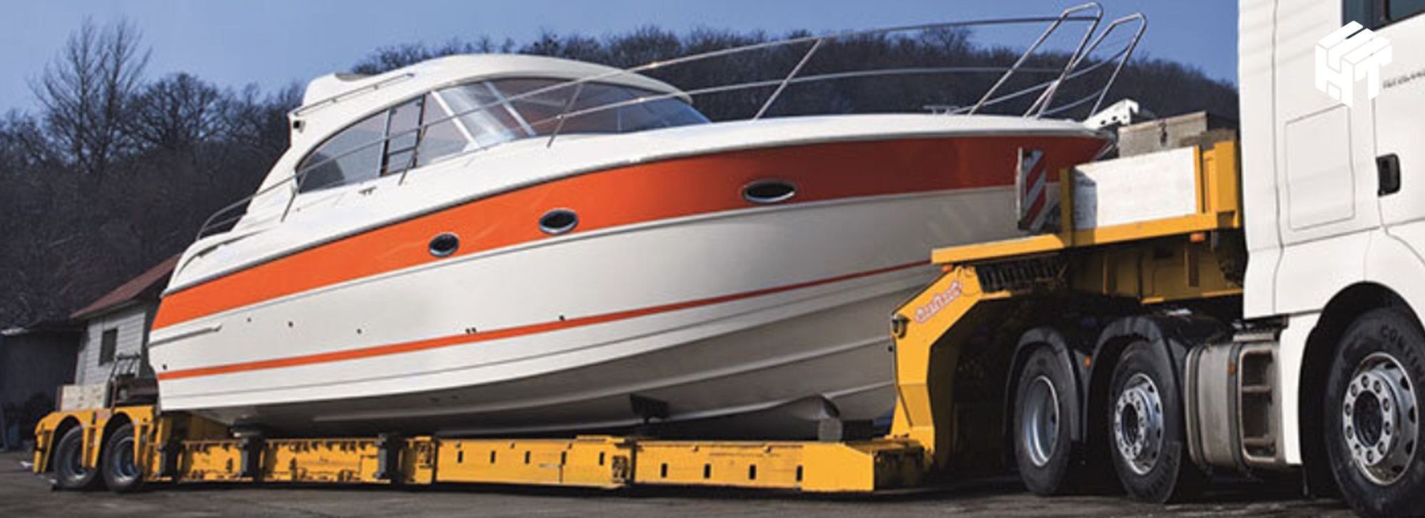
For larger vessels, especially during long relocations, many owners choose professional yacht transport services instead of navigating these unpredictable waterways themselves.
To better understand the logistical differences between these approaches, consider how water-based travel compares with professional overland relocation.
Factor | Water Route Planning | Overland Transport |
Main Variable | Weather and sea conditions | Road traffic and permits |
Mechanical Wear | High engine usage | No engine operation |
Predictability | Subject to tides and storms | Controlled highway routes |
Structural Stress | The hull flexes from the waves | Stable trailer support |
Scheduling | Weather-dependent | Planned delivery timeline |
While many boat owners enjoy the adventure of traveling by water, this comparison highlights why long-distance relocations favor controlled overland boat transport environments.
Modern navigation tools provide more data than ever before. Weather prediction models, AIS tracking systems, and digital charts all help improve the accuracy of long-distance planning.
However, relying on a single system can create blind spots. Professional navigators cross-reference multiple data sources before finalizing a route.
Wind forecast models help determine wave height and direction. AIS data reveals areas with heavy commercial traffic. Local maritime notices provide updates about hazards such as newly submerged debris or changing channel depths.
Combining these layers of information helps reduce risk and ensures your route remains safe and efficient.
When you take a comprehensive approach to boat route planning, you gain the confidence that every stage of the journey has been carefully evaluated.
Proper boat route planning helps reduce risk, control costs, and protect your vessel during long-distance moves. While some owners enjoy managing a long voyage themselves, others quickly discover how demanding the process can be.
At Set Sail Boat Transport, we focus on providing a controlled, efficient solution for relocating vessels across long distances. Our specialized trailers, experienced drivers, and detailed logistics planning allow your boat to travel safely without accumulating engine hours or facing unpredictable water conditions.
If you are preparing to move your vessel, our team is ready to help you simplify the entire process.
Contact Set Sailboat Transport today to request a quote and let our experts handle the heavy lifting for your vessel!